|

On eBay Now...
1862 Map| Map of the environs of Fort Donelson, Tennessee, Feb. 1862| Dover Regi For Sale

When you click on links to various merchants on this site and make a purchase, this can result in this site earning a commission. Affiliate programs and affiliations include, but are not limited to, the eBay Partner Network.

1862 Map| Map of the environs of Fort Donelson, Tennessee, Feb. 1862| Dover Regi:
$34.99
Map Size: 16 inches x 24 inches | Fits 16x24 size frame | Frame not included | Archival Quality Reproduction | 1862 Map|Title: Map of the environs of Fort Donelson, Tennessee, Feb. 1862|Subject: Dover Region|Dover Region Tenn|Fort Donelson Region|Fort Donelson Region Tenn|Fort Donelson, Battle Of, Tenn|Fort Donelson, Battle Of, Tenn., Manuscript|Tennessee|United States Notes: Shows Fort Donelson, town of Dover, \"Reported battery on Jackson\'s Hill\", obstructions on the Cumberland River, and mortar boats below the obstructions. Relief shown by form lines. At lower right in handwriting: Engr. Dept. July 18/64. Recd. with Gen. Cullum\'s letter of the 16th inst. (C. 5621). Oriented with north toward the lower left. Pen-and-ink (black) and watercolor (blue). Mounted on paperEach Map is Hand Printed in our StudioFine Art Matte Paper (230g, 14mil) that maintains vivid colors and faithfulness to the original map.Archival inks guaranteed not to fade for 200+ yearsYour map will be shipped in a protective tube via first class mail
Powered by SixBit\'s eCommerce Solution
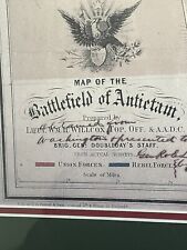
Battle Map Of Antietam September 17, 1862 Historical American Civil War $85.00
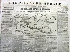
1862 Civil War newspaper MAP Fayetteville ARKANSAS Van Buren PRAIRIE GROVE Battl $40.00
1st Virginia Rebel Cavalry Invade Maryland 1862 Frederick MD Map Hagerstown $29.95

Map Set Mapset For THE BATTLE OF ANTIETAM - MORNING PHASE - September 17, 1862 $12.95
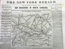
1862 Civil War newspaper w detailed MAP of NORTH CAROLINA Goldsboro to Kinston $40.00

1887 VINTAGE CIVIL WAR MAP-FIELD OF FREDERICKSBURG-ARMY POSITIONS-DECEMBER 1862 $7.00

1862 Map| Sketch of the vicinity of McDowell, Va.| Maps, Manuscript|McDowell Reg $34.99

1862 Map| The Antietam Campaign Sept. 1862| Antietam Campaign|Antietam Region|Ci $34.99
|


