|
|
|

|
|

On eBay Now...
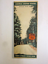
1942 PHILLIPS 66 Road Map CENTRAL UNITED STATES Route 66 Oklahoma Illinois Iowa For Sale

When you click on links to various merchants on this site and make a purchase, this can result in this site earning a commission. Affiliate programs and affiliations include, but are not limited to, the eBay Partner Network.

1942 PHILLIPS 66 Road Map CENTRAL UNITED STATES Route 66 Oklahoma Illinois Iowa:
$14.99
Vintagefold-out 1942 Phillips 66 road map of the central United States,printedmore than 77 years ago. - The map opens to 22" x 27½" and hasgreat detail on old highway alignments, including U.S. Route 66, withcartography by H.M. Gousha.
- The coverage area includes Illinois,Missouri, Oklahoma, New Mexico, Colorado, Wyoming, Nebraska, Iowa,Kansas, Arkansas, Indiana, Michigan, Minnesota, North Dakota, SouthDakota, and part of Texas.
- This map was distributed to motorists by the Phillips Petroleum Companyof Bartlesville, Oklahoma in 1942 and is dated by the code number inthe lower margin: P-1.
- Condition: This map is in very good, lightly usedcondition,bright and clean, with no marks, rips, or tears. Pleasesee the scans and feel free to ask any questions.
- Buy with confidence! We are always happy to combineshipping onthe purchase of multiple items — just make sure to pay for everythingat one time, not by SixBit's eCommerce Solution

VINTAGE CALENDAR Advertising 1942 PHILLIPS 66 Complete $19.99
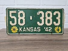
1942 Kansas License Plate Phillips County $39.99

VINTAGE CALENDAR Advertising 1942 PHILLIPS 66 VGC $20.00
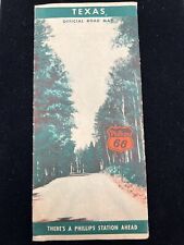
1942 Texas Official Road Map Phillips 66 Advertisement $6.50
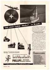
1942 Phillips Recessed Head Screws, Vintage WW2 Print Ad $9.37
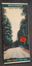
1942 Phillips 66 WISCONSIN Official Road Map $12.99
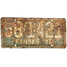
1942 United States Kansas Philips County Passenger License Plate 58-1421 $16.99
1942 Road Map Phillips 66 Central United States Michigan Illinois Indiana Tenn $24.95
|
|
|

