|

On eBay Now...
1771 Map of South Carolina | Savannah Sound | St. Helena\'s Sound | South Carolin For Sale

When you click on links to various merchants on this site and make a purchase, this can result in this site earning a commission. Affiliate programs and affiliations include, but are not limited to, the eBay Partner Network.

1771 Map of South Carolina | Savannah Sound | St. Helena\'s Sound | South Carolin:
$33.99
Map size: 22 inches x 24 inches | Ready to frame in standard size frame | Frame not included | Archival quality reproduction 1771 map. A map of South Carolina from the Savannah Sound to St. Helena\'s Sound, with the several plantations, their proper boundary lines, their names, and the names of the proprietors included and the grants of lands belonging to Landgrave William Hodgson, coloured green and edged with red with additional plans of those plots which have been resurveyed by order of Messrs. Boss & Brailsford the purchasers from Hodgson, who inherited from his ancestors, as they had their original grant, from the Palatinate Lord Carteret &c.
Powered by SixBit\'s eCommerce Solution

1771 Map| Map of the most inhabited part of New England, containing the province $34.99

1771 Map of Middle British Colonies | General Map of North America 1750-1789 | V $33.99

1771 Map of South Carolina | Savannah Sound | St. Helena's Sound | South Carolin $33.99
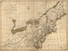
1771 Map of North America | North eastern States | Vintage North America Map | N $33.99

1771 Map| A general & particular Map of the island of Castle William near Boston $34.99

1771 Map of Middle British Colonies | General Map of North America 1750-1789 | V $34.99

1771 Map| Map of the most inhabited part of New England, containing the province $34.99

1771 Map | Tombecbe | Alabama | Tensa | Perdido | Scambia | River Map | West Fl $33.99
|


